

The Cirque of the Towers
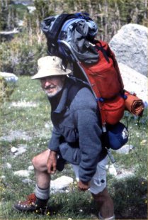
For an hour at the parking we sorted our jumble of climbing gear spread out across the tarmac. On a sunny July afternoon in 1990 Jeff Beyer had met me at the Salt Lake airport in his camping truck. We had yet to shop for food and so it was late when we embarked on the two-hundred mile drive to the gateway of Wyoming’s wild Wind River Range.
We passed Pinedale, Wyoming and by the time we reached gravel and dirt road country—fifty miles to go—night had fallen. The bouncing headlights startled an astonishing number of jack rabbits bounding this way and that as Jeff careened wildly left and right in attempts to avoid them. At Big Sandy Opening at last we stepped out into the quiet under a vast expanse of ebon sky framed by the ghostly tops of lodge pole pines and filled with to the brim with stars. We set up our tent and tucked in for the night.
Big Sandy (9,000 feet) is the trailhead for access to the Cirque of the Towers, an immense glacial basin in the Wind River Range surrounded by spectacular granite peaks as high as 12,000 feet. The Northeast Ridge of Pingora (11,900) and the East Ridge of Wolf’s Head (12,200) are listed in Steck and Roper’s Fifty Classic Climbs in North America. We hoped to reach their summits.
 At 10,400 the bowl of the cirque is 1,400 feet above Big Sandy but climbers must labor over Jackass Pass, an additional 400 feet, on the way in. Our acclimatization to altitude from sea level was effectively zero. Thus, with sixty pound packs, we found the gasping, halting slog to the pass almost un-doable. In fact, it was un-doable by sundown. We bivouacked for the night at the height of land by Arrowhead Lake and descended into the cirque just after dawn the next morning.
This cirque is vast—for those of you from New England—the width of about twenty-five of Mount Washington’s Huntington Ravines. We pitched the tent near a huge rock (easy to find—no?) and the next day climbed Pingora, but by an easier way than by the more challenging classic route. We switched leads to the summit from which we had a magnificent view of the first few pitches of Wolf’s Head’s storied East Ridge.
By the time we reached the tent again—it was hard to find—we realized that we had packed in nowhere near enough food to stay on without resupply, and reluctantly agreed that we’d have to hike out the next morning and return. I thought to fix the tent location using two lines of sight from the surrounding peaks and closer landmarks. On the way out, downhill and lightly loaded, we made good time and even detoured to climb close-by Sundance Pinnacle which featured a spectacular overhang on the very end of which to pose—an obligatory photo opp appropriately called the “Diving Board.”
On our return locating camp the next morning was easy. Walk to satisfy the first line of sight and then travel along that until aligning the second. Behold! The tent!
Before dawn the next day we set out for the classic route on Wolf’s Head. Climbing the steep face to gain the east ridge from above the talus (p0) was unexpectedly strenuous. Following Jeff I felt shaky and almost gave up at a hard corner, but his encouragement and some tension in the rope got us both safely onto the ridge. From there its first five-hundred feet curve upward like a suspension bridge cable; spectacular chasms on either side. I led the first and Jeff the next pitch to the end of the narrow edge, up a steep crack system, and into the chaotic jumble of gigantic blocks and gendarmes that comprise the higher reaches of the ridge.

Somehow we found the route for which we had no detailed description [1][2]. We just kept venturing, squeezing through crevices between towers, stepping gingerly along narrow ledges, now passing towers on the south and now on the north, by turns in deep shadow and open to the brilliant sky. One long memorable balance traverse (p8) I led on my toes stepping gingerly off at the end with my heart in my mouth. Jeff followed, wisely instead, with his hands on the ledge—nothing for his feet but friction on the steep wall below—and at the end stepped gracefully and safely over to me.
It fell to Jeff to lead the most airy pitch of all on the north side of the final tower.
In the jungle of granite blades the summit was hard to anticipate. We rested for a while at a place that seemed the highest and then turned our attention to getting down. We had no guide book description of the descent, having been assured that the rappel points would be sufficiently evident; collections of pitons and old slings left behind by those before us. And just such a nest of old gear was visible not far below to which we rappelled straightaway without much thought. From there, however, the way ceased to look promising; we could see nothing below to indicate previous passage and so, choosing a likely way, we tossed the rope ends into the air and I went down. At ropes-end I found a small edge on which to stand but there were no fissures or features there with which to anchor the next rappel and so, laboriously, I re-climbed the rope to Jeff. It took forever. We tried another way; this time finding a piton and one weathered sling. It was not really a much better indication of the right route but we backed up the piton and sling anyway, and carried on. By now the light was fading.
Six rappels in all, almost a thousand feet, deposited us at the top of a steep snowfield in the dark—only to confirm what we had begun to suspect for a while—that we were now in the wrong cirque. An exhausting trek clockwise and completely around the massive base of Pingora took many hours of stumbling along over the boulder strewn broken ground. Thankfully we had packed our headlamps and there were no serious technical obstacles. But, maddeningly, at the end we couldn’t find the tent owing to the invisibility of my daytime lines of sight. Eventually, after another exhausting hour of blind meanderings, we just happened upon it. Then ensued the sleep of the dead.
The Black Hills
We had a climbing date in South Dakota with some friends from Boston and so began a long drive east toward Rapid City. We camped out on BLM land near Ten Sleep Canyon, arriving the next day in Custer. Somewhere on US-16 near Moorecroft we noticed a barely visible speck on the northern horizon: Devil’s Tower.
Along the way we began to be aware of motorcycles. Then, more motorcycles. And farther east they seemed to fill the highway. What’s happening?

It wasn’t long before we had the answer: the week-long Fiftieth Anniversary of the Sturgis (SD) Rally [3][4]. By the time we reached Custer Harleys were ubiquitous, filling the streets and parked in endless (carless) rows along the curbs. We heard that there were 250,000 cycles and half a million riders. It was truly amazing. We camped again in isolation at the end of a long dirt road somewhere and all night—and in all of our four days in the area—we were never out of hearing of the proximate or distant roar of the infamous Harley Hog. The rumor was that ice—for the beer—had run out on the third day and was being trucked in by eighteen-wheeler from Denver.
Jeff, in an earlier incarnation, had owned a Moto Guzzi and had been for a while immersed in motorcycle culture. He became my guide to the Rally. Many of the leather jacketed and tattooed beefers were accompanied by their wives and girlfriends. However, there were many sturdy and confident women gunning their own throaty machines. Further, in the vein of the socially incorrect, along I-90 into Sturgis, hordes of bikers lined the sloping grassy banks, some with huge signs making inappropriate suggestions to the passing ladies riding pillion.
Jeff had his eye on a climb (5.8) called “Star Dancer” in back of the Presidential faces of Mount Rushmore. At the parking lot jammed with bikes the ranger estimated 25,000 for the day. We did the climb, a classic, and went on to visit the famous Needles where we encountered legendary climbing local Gene Larson [5]. He suggested “Overexposure” (5.8). I led a scary first pitch: a yard wide “chimney” between two of the “needles”; one foot and a hand on each wall and no protection until the first bolt fifteen feet up.
Devil’s Tower
Ultimately our friends from Boston were unable to join us and so we set off for Devil’s Tower [6] back in Wyoming—a hundred miles away.
 The Tower was first climbed in 1893 by two local ranchers using a wooden ladder the rungs of which were stakes driven into the longest continuous crack they could find [7]. The first mountaineering ascent is due to Fritz Wiessner, Bill House, and Lawrence Coveny who established the Wiessner route in 1937. In 1941 a guy parachuted onto the top and had to be rescued. By 1985 some 2,600 climbers had reached the summit, among them our own Henry Barber, Chip Lee, and Ajax Greene via new routes.
When at last we could see the Tower we were accompanied, now as usual, by myriad bikers and upon seeing the huge lineup at the ranger kiosk our fear was that we’d not get a campsite for the night. The creeping line was nearly an hour long; in it were barely a half-dozen cars. Finally and surprisingly, though, there were plenty of tent sites. Bikers are by and large day trippers only; not into roughing it. By dusk all was quiet.
We made a mountaineer’s “alpine” start; up before dawn and well underway before sunrise, hoping to be the first on our route, the Durrance [8], the easiest way to the top. The sun was just rising as we left the visitor center permitting me to get a photo’ of the Tower’s shadow stretching far away across the western desert.
The route was open. The first pitch attains the top of a basaltic column broken off from the main mass of the Tower and leaning against it. I agreed to the first lead and, despite some misgivings, found it easier than I had feared. Jeff took the next, harder pitch.
The columns are largely hexagonal prisms more than a yard across and separated by inches wide cracks inside of which jammed hands and toes can find tenuous grips. This pitch was steep and our longest; maybe one-hundred feet. The uniformity of the column cross sections render each move upward an exact repetition of the one previous. The cracks make it pretty safe because camming devices fit into them but their continuous similarity meant that Jeff wished his varied assortment of cams had been all of the same size.
Eventually from high above I faintly heard “off belay,” disassembled my anchor, and followed the pitch.

In my recollection we climbed it in three or four pitches. The top of my next pitch had a scary (but very satisfying) “jump” across air and after another scramble pitch, we were at the top. In the center of this tiny elevated patch of desert scrub was a cairn and we sat for a while to enjoy the view and have a bite. The famous Vulgarian sign-post of yore and lore was gone: “No climbing beyond this point.”
I had a moment of difficulty on the first rappel. Near the end of the ropes I could see that I was inconveniently far to the left of the next anchor and that I would need both hands—as well as both feet—to make it over there. I had to think about what I was doing. Tying off the rappel, traversing over, and releasing the knot again to descend a few more feet to the anchor had to be accomplished free of error.
By the time we reached the tourist path around the base of the Tower the Harley hoards had arrived. While making our way back to the car, festooned in ropes and gear as we were, every group we encountered stopped us. And in every case their queries were the same and asked in the same order, over, and over.
“Are you going to climb it?” We just did.
“How long did it take?” About four hours.
“Did you get to the top?” Yes.
“What’s up there? A patch of desert about the size of the parking lot.
“How did you get down?” We rappelled. (Rappelled? What? Etc.)
In the last leather jacketed biker group—with all the same queries—was a tall, stunning blonde in a white shirt open to an overhand knot at the navel, leaving nothing whatsoever to our poor, unwashed imaginations. We were poleaxed.
And so we had topped the “Towers” and gotten safely down and, almost, without pain. The roar and then the muttering of the “Hogs” faded away and we returned, until the next time, to the real and horizontal world.
[1] A wonderful SuperTopo log of the route with beautiful photo’s: http://www.supertopo.com/tr/South-Buttress-of-Pingora-and-East-Ridge-of-Wolfs-Head-Linkup/t12247n.html
[2] First ascent by Fred Becky: Bonney, O.H. & L.G., Field Book the Wind River Range, Bonney & Bonney, 1960, pp. 480-481:
http://publications.americanalpineclub.org/articles/12196354802/Field-BookThe-Wind-River-Range-from-Guide-to-the-Wyoming-Mountains-and-Wilderness-Areas-with-Supplement
[3] Wikipedia: https://en.wikipedia.org/wiki/Sturgis_Motorcycle_Rally
[4] New York Times: http://www.nytimes.com/1990/08/11/us/dakota-town-shaken-by-250000-biker-rally.html
[5] Gene Larson: http://sylvanrocks.com/history_custer/photographers_peak/just_another_pretty
[6] Devil’s Tower: https://en.wikipedia.org/wiki/Devils_Tower
Also: NPS webpage.
[7] Gardiner, S. and Guilmette, R., Devil’s Tower National Monument; a Climber’s Guide, 1986, The Mountaineers.
[8] The Durrance route with many photo’s: https://www.mountainproject.com/photo/108391740/123-jump
This one is the jump across.
